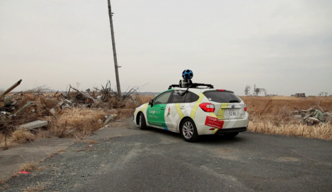
Google Using Street View To Map Japan’s Nuclear Exclusion Zone Around Fukushima
Google has started digitally mapping neighborhoods close to the Fukushima nuclear plant with the intent to digitally archive the devastation caused by the massive tsunami that took the lives of nearly 20,000 people and caused the nuclear power plant to fail. Google uploaded a new video this week showing that one of the companies ‘street view’ cars is in Namie for the first time to capture what the area looks like.

Google along with ABC News reporters drove through the empty town, steering around collapsed homes and cracked roads to capture a 360 view of the damage. No special clothing was worn, but the crew was out of zone within three hours. You can take a look at a video (in Japanese) of the trip into the town and some of the images that the car street view car recorded.

Comments are closed.